
The Cartographer's Annual 2017
October ’17
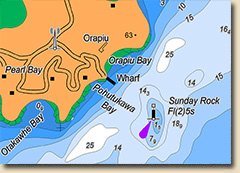
The October issue brings you a new drawing style inspired by Ralf's travels in the southern hemisphere: Marine Maps lets you create your own sea charts!
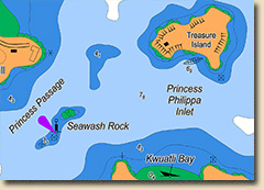
Based on modern charts for marine naivgation in coastal waters, the style Marine Maps allows you to recreate actual real-world maps, tweak them to your own uses, or create real-looking charts for your fictional coasts.
The tutorial pack Marine Maps includes
- 1 new drawing style
- 33 new drawing tools
- 2 new templates (imperial and metric)
- 38 new symbols
- 1 5-page mapping guide
- 2 example maps (PNG and FCW format)
- 1 new effect setting