
The Cartographer's Annual Vol 2
December ’08
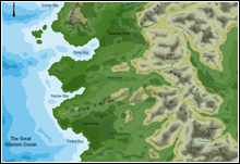
The December issue offers the tools to create a type of map that has previously been difficult to create with CC3: shaded relief maps. These maps use shadows and shading to depict changes in elevation and thereby give a good visual impression of hills or mountains.
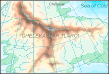
New templates, drawing tools, bitmap fills and textures allow you to create your own shaded relief maps.
The style pack Shaded Relief Maps includes
- 2 example maps (with png exports included)
- 2 new template wizards
- 1 new symbol catalog including 11 new symbols
- 6 new bitmap fills
- 6 new filter textures
- 1 new drawing style
- 30 new drawing tools
- 1 new effect setting
- 1 3-page mapping guide